 |
June 21, 2000
The “7” Site
In 1940, the bones of a castaway were found on Nikumaroro. It now appears possible – even probable – that the deceased person was Amelia Earhart (see Amelia Earhart’s Bones and Shoes?). Searches carried out by British authorities at that time collected a partial skeleton and a few artifacts (see The Bones Chronology) which have since been lost (see The Fiji Bone Search). TIGHAR’s next expedition to Nikumaroro will attempt to find the castaway’s bones that were not recovered in 1940 plus any additional artifacts which may survive. A successful DNA match would be the long-awaited conclusive proof of Earhart’s fate.
But to do the search, we need to figure out where the original discovery was made. Three candidate sites – Kanawa Point, the Aukeraime site, and the “7” site – have been identified and evaluated based upon the available clues (see Gallagher’s Clues). Of these, the “7” site appears to be the most promising and is now scheduled for intense examination during Niku IIII, our next expedition to the island.
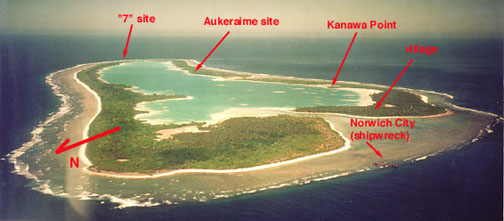
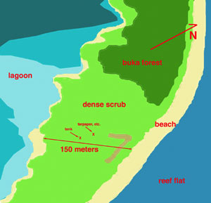 We
call it the “7” site because it features a unique pattern of
coral rubble which is naturally devoid of vegetation and, from the air,
forms a distinctive number “7.” This seems to be a coincidence
of nature and does not seem to be man-made. However, other aspects of the
site are definitely man-made (see Gallagher’s
Clues and Signs of Recent
Habitation?). The general character of the site depicted below is
based upon the brief initial survey done by TIGHAR in 1996.
At present, our working hypothesis is that the tank and tarpaper and other evidence of human occupation we found there in 1996 are the result of operations carried out in 1940 in response to orders from the Western Pacific High Commission for the island’s administrator, Gerald Gallagher, to carry out an “organized search” for more bones and artifacts.
The approximate cross-section of the land is depicted below. No measurements of elevation were taken in 1996 but the difference between high point and low point is very modest – not more than ten feet.

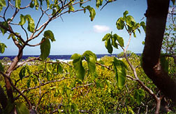 This
view looks toward the ocean.
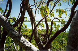 This
view looks toward the lagoon.
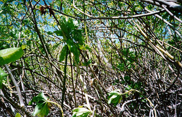
On the ground, the view is rather different. The tangle of scaevola is nearly impenetrable.
But the “7” site was not always as inhospitable as it is now. Aerial photos taken in 1937, 1938, 1939, and 1941 present a very different picture and enable us track some interesting changes in the site’s appearance and may provide clues to what happened there.
On July 9, 1937 three floatplanes from the U.S.S. Colorado flew over Nikumaroro (then known as Gardner Island) during the search for Amelia Earhart. The only photo known to have been taken at that time happens to include the “7” site. Although resolution is very poor, the photo does provide the earliest known aerial view of the site. (For a complete version of the photo see The Lambrecht Photo.)
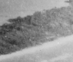
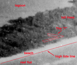 If
our speculation is correct that Earhart and Noonan landed near the shipwreck
on the west end of the island on July 2nd, it seems unlikely that one
or both of them were on this opposite end of the island only one week
later.
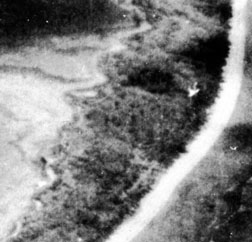
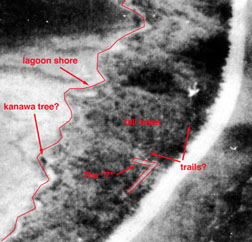
The next aerial photo was made just five months later on April 30, 1939 by an airplane from the seaplane tender U.S.S. Pelican. This is a direct overhead shot that was part of an aerial mosaic of the entire island. A work party of 10 men had arrived in late December and, just two days before this photo was taken, their families (12 people) had finally arrived. Rainfall had returned to normal and the island was beginning to return to its more usual appearance. No “trails” are in evidence and the tree on the lagoon shore seems to be present, although not as prominently visible from directly overhead.
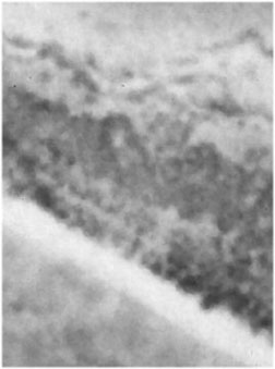
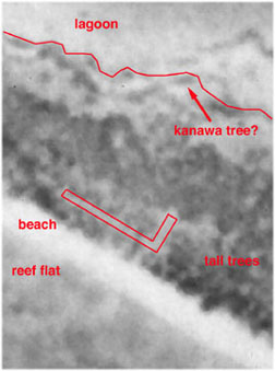
Just over two years would pass before another aerial photo was taken, this time by one of a least four U.S. Navy PBYs that visited the island on June 20, 1941 as part of an intelligence gathering survey of islands in the area. A lot had happened in that time.
According to Gallagher, the kanawa tree on the lagoon shore was cut down around December of 1939. Then in roughly April of 1940, a skull was found and buried by a work party (Doing what? Cutting down more kanawa trees?). In September 1940 Gallagher arrived, heard about the skull, and by September 23 had conducted what he termed a “thorough search” and found bones and artifacts. On October 17 he advised his superiors that an “organized search” would take “several weeks as crabs move considerable distances and this part of island is not yet cleared.” On October 23, Dr. Macpherson in Fiji recommended that “the search be continued with a view to discovering farther [sic] bones, personal trinkets, etc.” and on October 26 the Secretary of the High Commission wired Gallagher that an “Organised search should be made in the vicinity….” Finally, on December 27, 1940, in a letter accompanying the bones and artifacts as they were shipped off to Fiji, Gallagher confirmed that an “intensive search” had been made. (See The Bones Chronology.) Gallagher himself left Nikumaroro for temporary duty in Fiji on approximately June 12, 1941 and so was not present on the island when the U.S. Navy PBYs made their visit and took their photos on June 20. Did all this activity described by Gallagher take place at or near the “7” site?
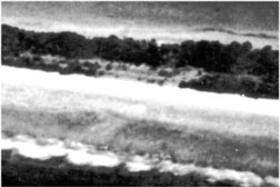
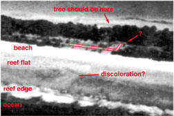 A
detail of one of the photos taken that day shows the “7” site from the
seaward side and appears to exhibit considerable evidence of human activity.
The low angle of the photo makes it hard to say whether the tree – thought
to possibly the kanawa tree mentioned by Gallagher – is present. A considerable
amount of beachfront vegetation seems to have been cleared since the previous
photo and a fairly large, rectilinear object (perhaps 5 feet on each side
and 12 feet high) seems to have appeared. There also appears to be some
discoloration of the reef flat directly in front of the cleared area.
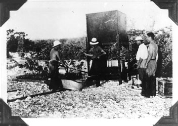 Just
what the significance of these changes may be is unknown at this time,
but a water condensing unit used during the 1938/39 New Zealand survey
of the island bears a striking resemblance to the object in the photo.
This particular condenser was at the other end of the island and, according
to the survey report, didn’t work anyway, but the photo does at least
show what water condensers looked like in those days.
In summary, it would appear that there is photographic evidence of:
- Human activity (i.e. trails) associated with the “7” site before the island was officially inhabited.
- Human activity (i.e. clearing, etc,) associated with the “7” site that is consistent in time and appearance with the "organized search" carried out by Gallagher.
The hypothesis that the “7” site is the place where the remains of the castaway were found is, therefore, supported by these data. That hypothesis will be tested by a detailed examination of the site and the surrounding area during Niku IIII, TIGHAR’s next expedition to Nikumaroro now scheduled for the summer of 2001.
