Uploads by Rypinski
Jump to navigation
Jump to search
This special page shows all uploaded files.
| Date | Name | Thumbnail | Size | Description | Versions |
|---|---|---|---|---|---|
| 02:28, 22 July 2009 | CantonAirfield1971.jpg (file) |  |
46 KB | Photo by John F. Porth, circa 1970-1971, showing aerial view of Canton Island airfield from WNW. Photo taken from USAF CH-3E. pls cite "courtesy Jack Porth" | 1 |
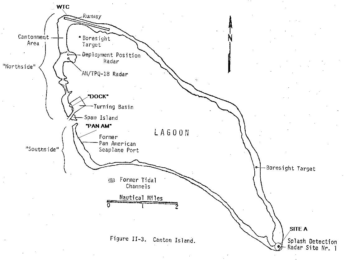
| 02:23, 22 July 2009 | CantonMap3 USAF1973.jpg (file) |  |
82 KB | Sketch map of Canton Island, circa 1973, from: USAF Environmental Health Laboratory, Kelly AFB, Texas, "Environmental Survey of the Phoenix Islands Central Pacific Ocean," EHL(K) 74-18 August 1974 US Govt--public domain, no copyright. | 1 |