The Survey

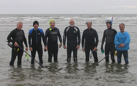
TIGHAR carried out survey operations on the beach over a span of four days from October 8 to 11, 2007. The TIGHAR team was made up of seven members from the United States:

Project Director: Ric Gillespie
Team
Deputy Project Archaeologist: Gary Quigg
Field Technicians: John Clauss
  Craig Fuller
  Walt Holm
  Andrew McKenna
  Tom Roberts

Left to right: Ric Gillespie, Walt Holm, Craig Fuller
Tom Roberts, Gary Quigg, Andrew McKenna, John Clauss.
TIGHAR photo.

TIGHAR’s Project Archaeologist Thomas F. King, Ph.D., provided a close review of the planning, field methodology and report preparation.

Invited visitors to the site often provided helpful consultation and advice.  They included representatives from the Imperial War Museum, Duxford the Clwyd-Powys Archaeological Trust; the University of Wales, Lampeter; the Gwynedd County Council; the Gwynedd Archaeological Trust; and Snowdonia National Park.

Day One

On October 8 the team arrived at the site at approximately 13:30. Work on site is possible only at low tide. Low tide is limited to a two hour window, which during our work was generally between 14:00 and 16:00 each day.

On the 8th the team performed an initial inspection of the area, which confirmed that the wreckage is indeed a P-38 fighter aircraft.

At the time of the survey, natural erosion of the sand had exposed much of the aircraft. Since the survey the sands have once again shifted and, like the mythical village of Brigadoon or the Welsh legend of the Bells of Aberdyfi, the fighter has vanished – this time to await its recovery in the spring.

Upon losing the low tide, site management duties for the following day were discussed before the group hiked back for the evening.

Day Two

Pounding stake

John Clauss and Tom Roberts set a base post. TIGHAR photo by W. Holm.

On October 9, all participants returned to the wreckage site and began survey and documentation duties. John Clauss and Tom Roberts began Kite Aerial Photography (KAP) at 13:30. Clauss and Roberts then joined Gary Quigg in laying out supporting metal posts for a measured twenty meter baseline from which to record the location of significant features within the site.

Andrew McKenna, Walt Holm and Craig Fuller began taking reference photographs and writing a detailed description of damage, deterioration and marine encrustation.

Ric Gillespie began a systematic metal detector sweep around the airframe and nearby areas.

The two hour low tidal window passed quickly, and the team retreated from the surf at 16:20.Ric Detecting

Ric metal detecting around the site. TIGHAR photo by W. Holm.

Kite

The kite, with camera underneath, surveys the scene. TIGHAR photo by C. Fuller.

Day Three

Walt and GPS

Walt Holm takes GPS readings. TIGHAR photo by R. Gillespie.


The third day on site, October 10, provided excellent conditions for fieldwork with calm seas and full sunshine. Clauss, McKenna, Quigg and Roberts took measurements to fifteen important points on the airframe from the baseline. Holm took Global Positioning System (GPS) readings at designated points.

Clauss and Roberts continued KAP, capturing some remarkable overhead images of the site. Holm, McKenna, and Fuller continued with photographic documentation while taking detailed written notes of damage/deterioration/encrustation. Gillespie continued metal detection. Gillespie also worked with Quigg gathering additional measurements and served as public liaison to the many visiting professionals.

Quigg also began the preparation of a measured sketch-map. The loss of low tidal conditions at 16:20 concluded the workday.

Ric and Nigel

Ric Gillespie and Nigel Nayling discuss the site. TIGHAR photo by W. Holm.

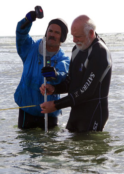
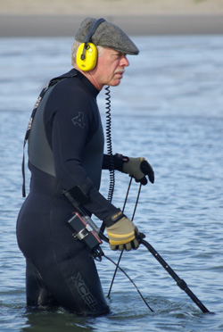
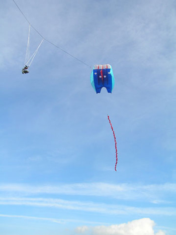
Day Four

October 11 was the final day on site, and conditions were more challenging with moderate winds creating a slight chop. However the increased winds allowed for greater altitude images from the KAP which Clauss and Roberts continued, taking care to obtain larger contextual photographs of the site.

Final measurements were taken from the baseline by Clauss, McKenna, Roberts and Quigg. Fuller, Holm and McKenna completed photographic and written documentation of damage/deterioration/encrustation. Quigg completed mapping and videotaped the site.

Gillespie, assisted by Holm, completed metal detecting in a ten meter box outside the airframe, finding a number of isolated hits. As the survey was specifically limited to non-invasive techniques, the TIGHAR team made no attempt to excavate in or around the airframe or to uncover the metal detector hits for identification.

Work was completed by 16:15, whereupon the group policed the area to assure no trace of our work there was evident, packed all gear and retired from the site.


The Lightning The Discovery The Accident Ownership
Significance The Survey Plans Participate

About TIGHAR Join TIGHAR TIGHAR Projects TIGHAR Publications Contract Services
The TIGHAR Store TIGHAR Forum Contact TIGHAR TIGHAR Home

TIGHAR logo

Copyright 2021 by TIGHAR, a non-profit foundation. No portion of the TIGHAR Website may be reproduced by xerographic, photographic, digital or any other means for any purpose. No portion of the TIGHAR Website may be stored in a retrieval system, copied, transmitted or transferred in any form or by any means, whether electronic, mechanical, digital, photographic, magnetic or otherwise, for any purpose without the express, written permission of TIGHAR. All rights reserved.

Contact us at: info@tighar.org  •   Phone: 610.467.1937   •   JOIN NOW