 |
Earhart Project Research Bulletin
February 25, 2010
Where is the Electra? Connecting The Dots What Might we Find?
| Connecting the Dots |
Some of the clues are stronger than others. Forensic imaging from two photos is much more reliable than an anomaly in a single photo. Human memory is notoriously frail, but it is interesting that all of the clues, so far, appear to tell a consistent story that conforms with the known natural forces affecting wreckage distribution as evidenced by debris from the Norwich City shipwreck.
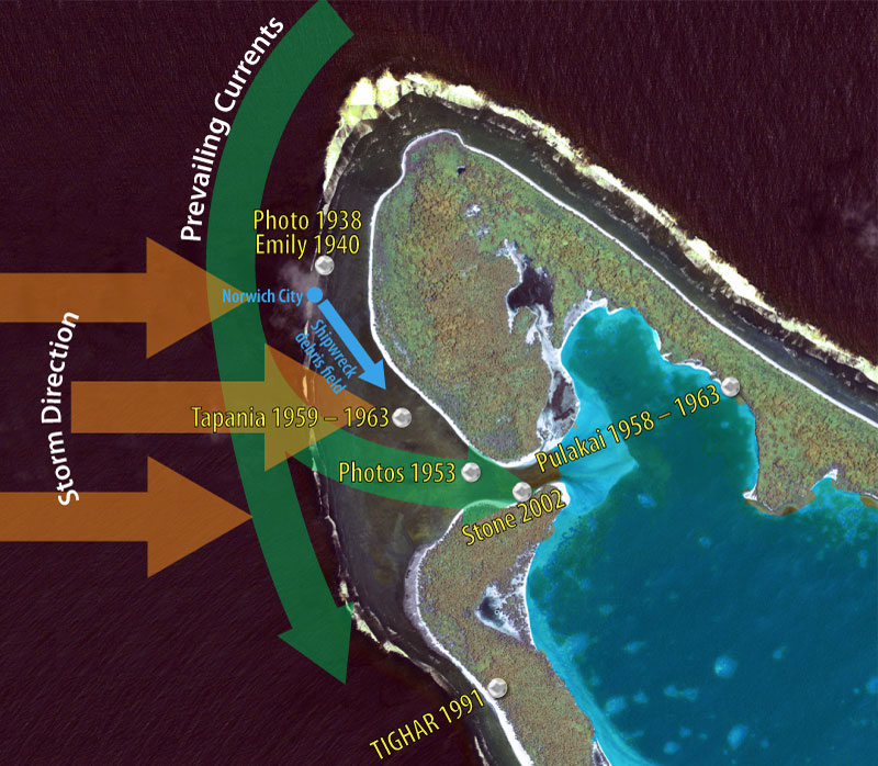
Breakin’ Up Is Hard To Do
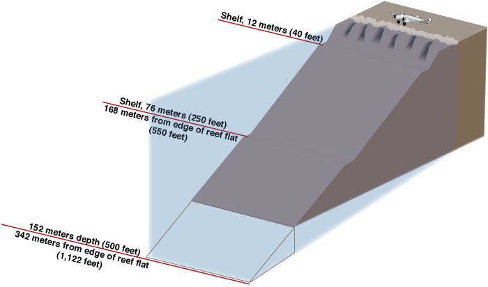
This is how the Electra may have broken up over time in such a way as to explain the various photos and reports of wreckage seen and not seen. We have good information about the reef surface where the plane seems to have landed, and good information about the underwater environment down to about 100 feet. Beyond that we have only general information from soundings done by the U.S. Navy in 1939. The shelf at 250 feet may or may not be there. It was reported by a diver on a New England Aquarium expedition in 2002 who was suffering from nitrogen narcosis.
NR16020 is landed near the surf line on the dry reef north of the Norwich City shipwreck. July 2 – 6, 1937 Earhart and Noonan send radio distress calls during hours of darkness and low tide. |
||
Rising tides and surf wash the aircraft into one of the “spur and groove” features where it is swept into shallow water in the surf zone. July 9, 1937 Breaking surf hides the aircraft from view when the Navy search planes fly over the island. |
||
The aircraft remains largely intact but hidden from view in shallow water just off the edge of the reef. Parts of the wreck are visible above water at unusually low tides on calm days. 1939 Fishermen from the new island settlement discover the wreck and salvage useful pieces. They know it’s an airplane but have no interest in what airplane it is or how it got there. Spring or summer 1940 Emily Sikuli sees some of the wreckage on the reef on a calm day at low tide. |
||
Severe westerly weather shifts the wreck onto a reef shelf at a depth of about forty feet. 1941 – 1952 The airplane remains on the reef shelf, battered but largely intact. |
||
The wreck begins to break up due to time and storms. Lightweight pieces travel southward along the reef face with the prevailing current. Some are thrown up on to the reef flat in storms. Buoyant wreckage (fuel tanks, wooden flooring) goes through the lagoon passage and washes up on the opposite lagoon shore where it is seen by Pulakai Songivalu. 1958 – 1963 Wreckage continues to wash up on to the reef flat and beach to be salvaged and used by the colonists. Other lightweight underwater debris becomes more widely scattered. |
||
Storm action has shifted debris below 100 feet (diver limit). |
||
Where is the Electra? Connecting The Dots What Might We Find? |
||
 July 2,1937
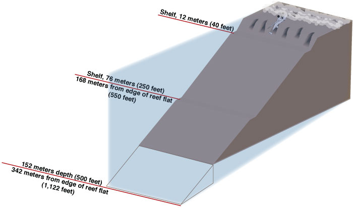 July
7 or 8, 1937
July
7 or 8, 1937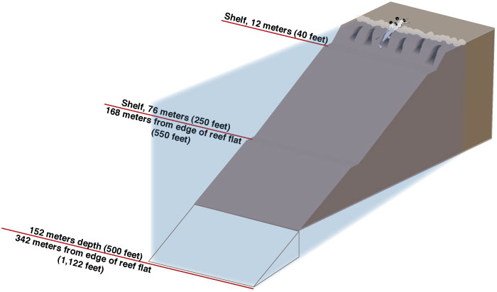 December 1, 1938
 November 1940
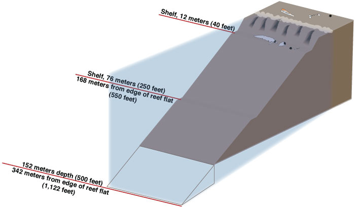 1953
1953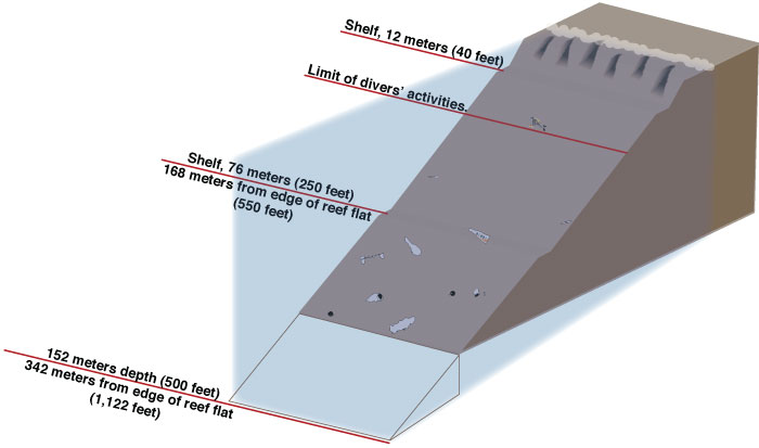 By 1989 (first TIGHAR expedition)