File:Portolan Chart 1024.png
Jump to navigation
Jump to search
Size of this preview: 707 × 600 pixels. Other resolution: 1,024 × 869 pixels.
Original file (1,024 × 869 pixels, file size: 36 KB, MIME type: image/png)
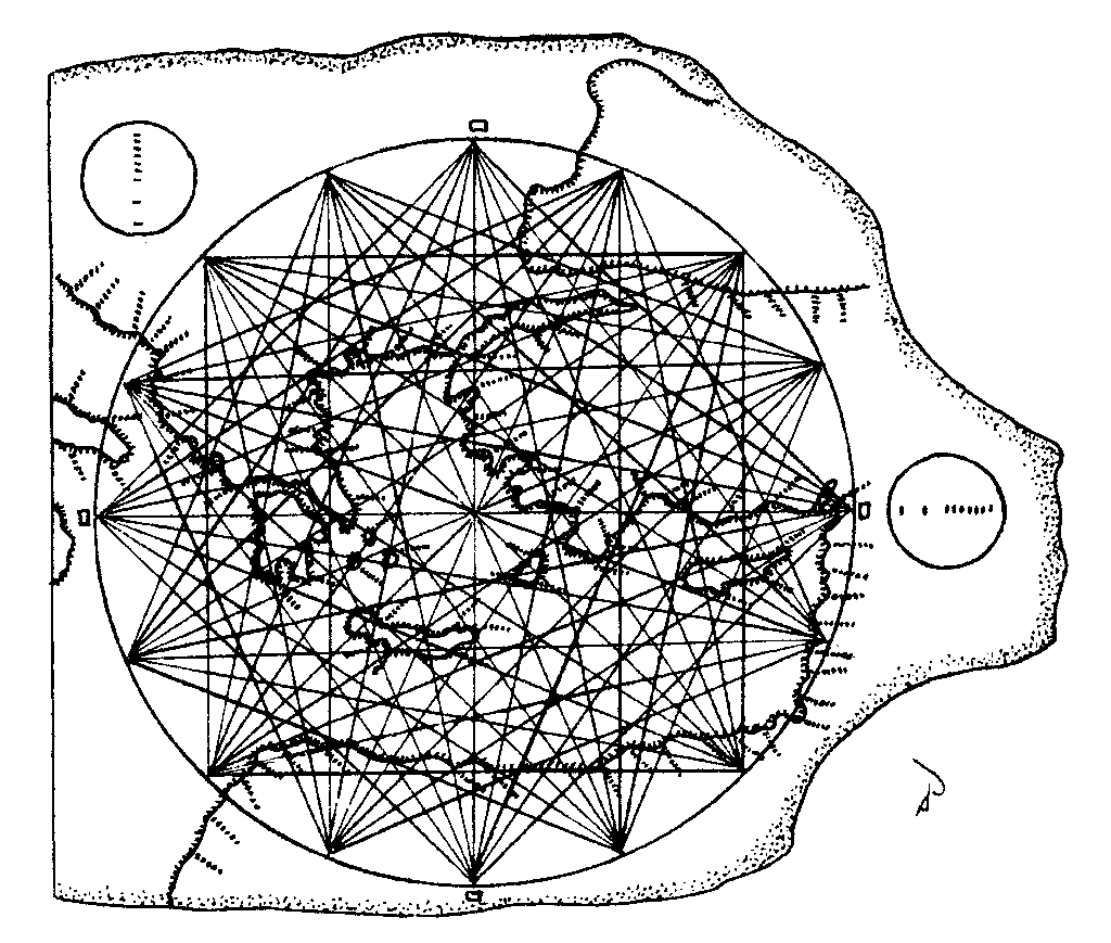
Enhanced drawing of the Carta Pisana portolan navigational chart showing the method of portraying magnetic compass courses to the principal central and eastern Mediterranean ports. The mileage scale is depicted in the circles. Pilots did not reference latitude and longitude which are not portrayed on portolan charts. Courtesy, Douglas T. Peck, and http://www.NewWorldExplorersInc.org .
File history
Click on a date/time to view the file as it appeared at that time.
| Date/Time | Thumbnail | Dimensions | User | Comment | |
|---|---|---|---|---|---|
| current | 01:22, 11 October 2010 | | 1,024 × 869 (36 KB) | Moleski (talk | contribs) | Enhanced drawing of the Carta Pisana portolan navigational chart showing the method of portraying magnetic compass courses to the principal central and eastern Mediterranean ports. The mileage scale is depicted in the circles. Pilots did not reference lat |
You cannot overwrite this file.
File usage
The following page uses this file: