Google Earth
Some say "seeing is believing"--but we can't believe everything we see, especially in satellite imagery taken from Google Earth.
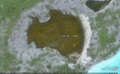
The process of capturing, digitizing, and combining satellite images often produces digital artifacts (not to be confused with archeological artifacts!.
Click on the pictures to see a larger image and to get the coordinates for use in Google Earth. You can play the "Do You See What I See?" game, too!
-
 Atlantis of Nikumaroro.
 -
 A cry for ELP?
 -
 The Niku Triangle.


[Category:Research Methods]]