File:CantonMap3 USAF1973.jpg
Size of this preview: 795 × 600 pixels. Other resolution: 1,108 × 836 pixels.
Original file (1,108 × 836 pixels, file size: 82 KB, MIME type: image/jpeg)
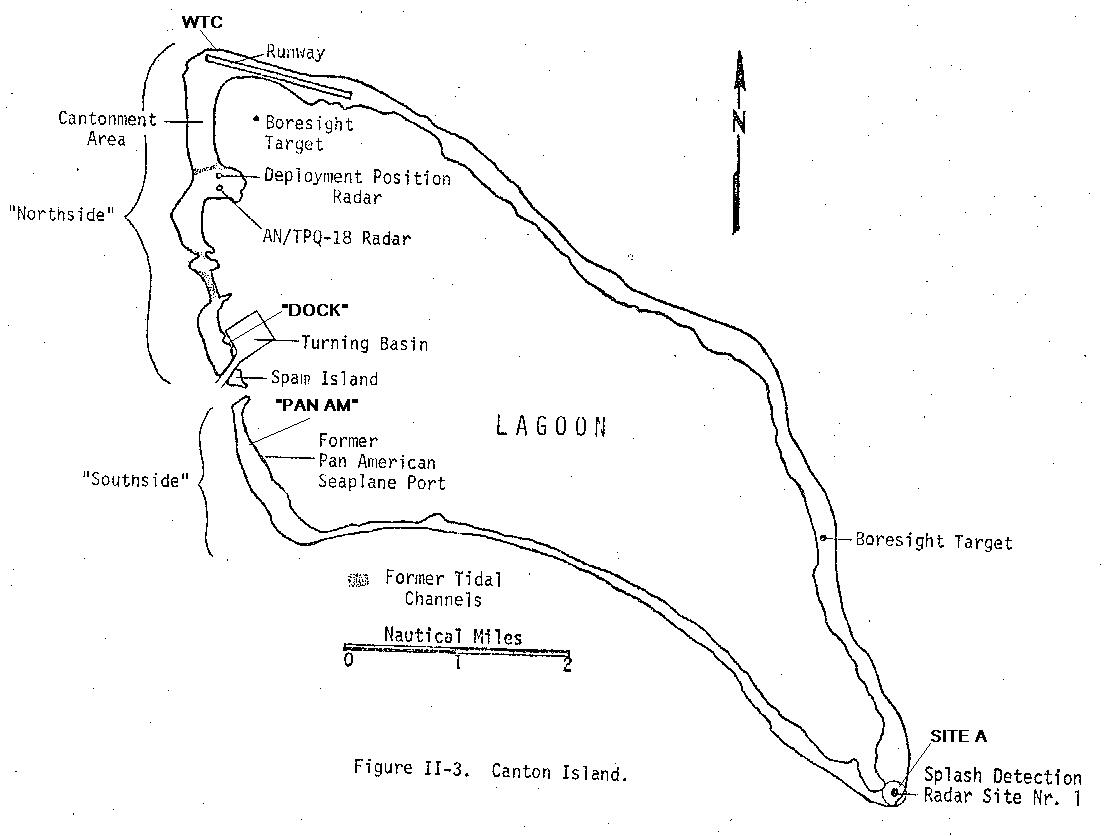
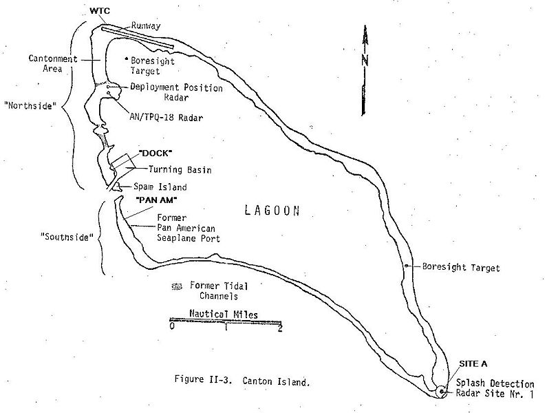
Sketch map of Canton Island, circa 1973, from: USAF Environmental Health Laboratory, Kelly AFB, Texas, "Environmental Survey of the Phoenix Islands Central Pacific Ocean," EHL(K) 74-18 August 1974
US Govt--public domain, no copyright.
File history
Click on a date/time to view the file as it appeared at that time.
| Date/Time | Thumbnail | Dimensions | User | Comment | |
|---|---|---|---|---|---|
| current | 02:23, 22 July 2009 | | 1,108 × 836 (82 KB) | Rypinski (talk | contribs) | Sketch map of Canton Island, circa 1973, from: USAF Environmental Health Laboratory, Kelly AFB, Texas, "Environmental Survey of the Phoenix Islands Central Pacific Ocean," EHL(K) 74-18 August 1974 US Govt--public domain, no copyright. |
You cannot overwrite this file.
File usage
There are no pages that use this file.