Uploads by Moleski
Jump to navigation
Jump to search
This special page shows all uploaded files.
| Date | Name | Thumbnail | Size | Description | Versions |
|---|---|---|---|---|---|
| 22:08, 8 June 2011 | Bookcase-national-archives.png (file) |  |
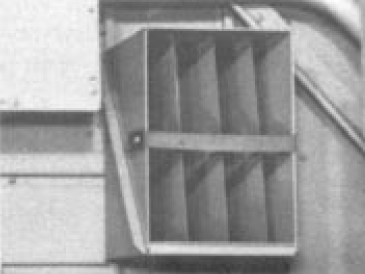
53 KB | Courtesy of National Archives. http://tighar.org/Publications/TTracks/1991Vol_7/0702.pdf | 1 |
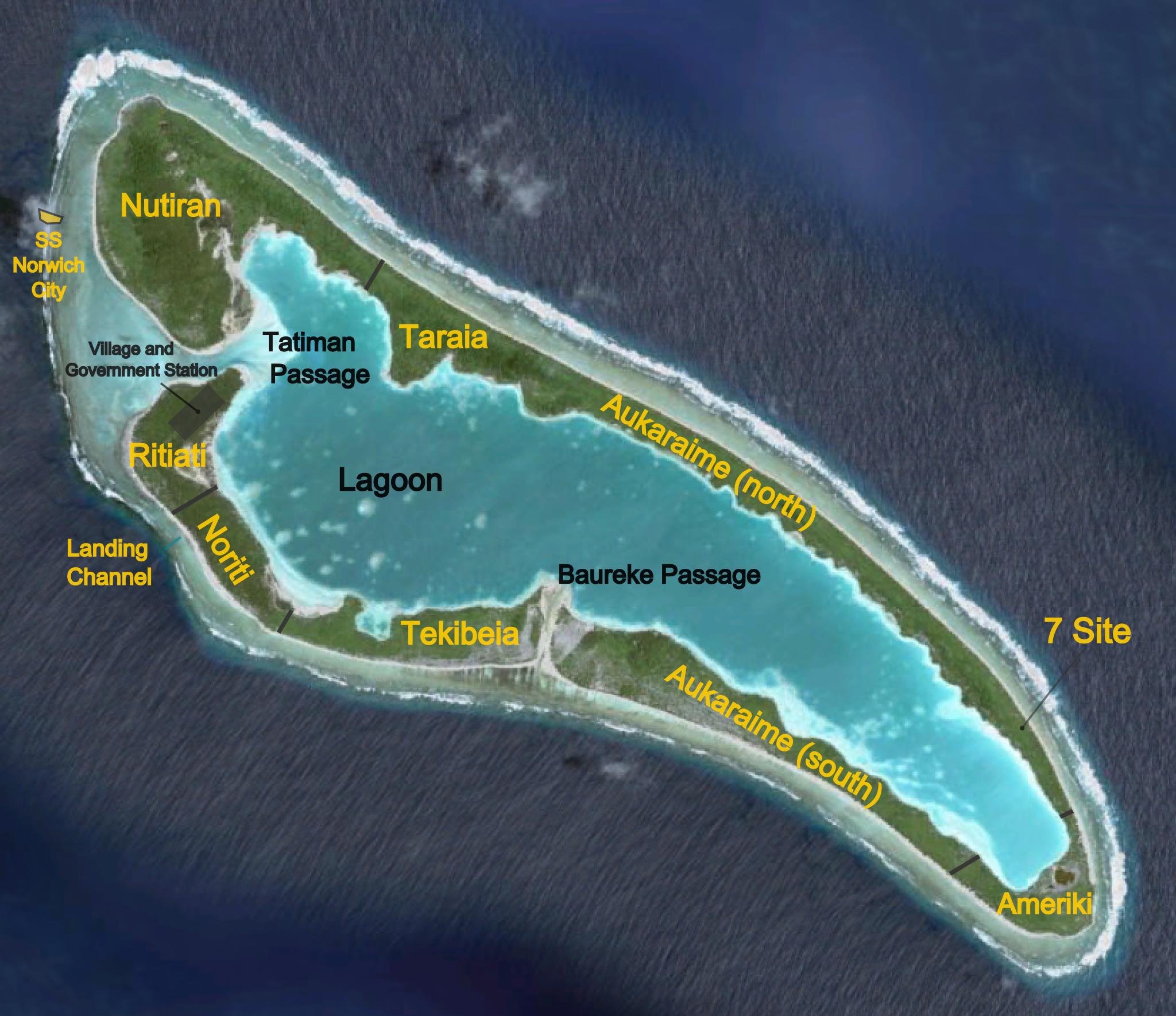
| 13:36, 25 May 2011 | Niku-placenames.png (file) |  |
2 MB | Based on Google Earth and a TIGHAR map of evidence found. MXM, SJ. | 1 |
| 03:45, 24 May 2011 | CIA-Pacific.png (file) |  |
747 KB | https://www.cia.gov/library/publications/the-world-factbook/graphics/ref_maps/pdf/oceania.pdf CIA Factbook. | 1 |
| 12:28, 23 May 2011 | 2011-05-23 0824.png (file) | 31 KB | 1 | ||
| 12:28, 23 May 2011 | 2011-05-23 0820.png (file) |  |
55 KB | 1 | |
| 12:27, 23 May 2011 | 2011-05-23 0818.png (file) |  |
32 KB | 1 | |
| 14:27, 20 May 2011 | 2011-05-20 1021.png (file) |  |
25 KB | 1 | |
| 14:27, 20 May 2011 | 2011-05-20 1020.png (file) |  |
47 KB | 1 | |
| 14:26, 20 May 2011 | 2011-05-20 1019.png (file) |  |
44 KB | 1 | |
| 01:46, 19 May 2011 | Auck05-024.jpg (file) |  |
419 KB | Picture taken by Martin X. Moleski, SJ; Auckland, 2003. All rights reserved by TIGHAR. | 1 |
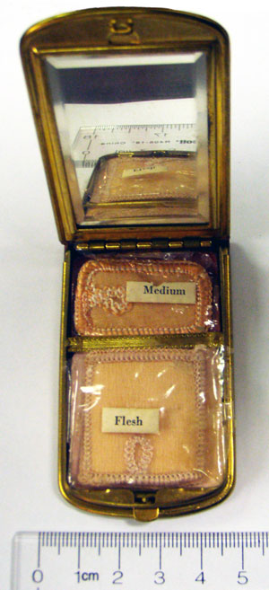
| 11:26, 4 May 2011 | Mondaineopen.jpg (file) |  |
50 KB | http://tighar.org/Projects/Earhart/Archives/Expeditions/NikuV/Analysis_and_Reports/Compact/NikuVanalysismetalfrag.html | 1 |
| 12:15, 24 April 2011 | GilbertIslandsPos.png (file) |  |
1,000 KB | Author: [http://commons.wikimedia.org/wiki/User:Pitichinaccio Pitichinaccio.] Obtained from Wikimedia Commons under GNU Free Documentation License. | 1 |
| 13:35, 23 April 2011 | Roger 047.jpg (file) |  |
1.18 MB | 1 | |
| 13:33, 23 April 2011 | Roger-046.jpg (file) |  |
1.22 MB | 1 | |
| 13:23, 2 April 2011 | 2011-04-02 0918.png (file) |  |
66 KB | 1 | |
| 01:02, 11 March 2011 | Niku map (1935).jpg (file) | .jpg) |
70 KB | http://tighar.org/Publications/TTracks/1996Vol_12/1202_3.pdf | 1 |
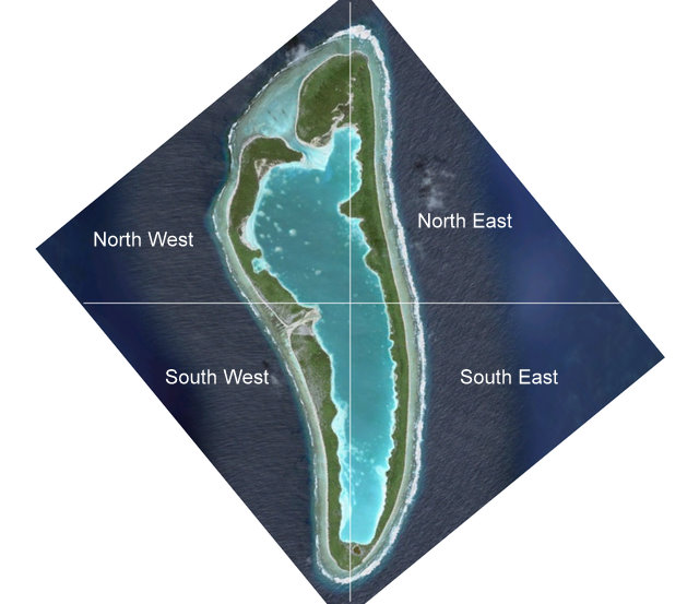
| 20:13, 9 March 2011 | Niku-quadrants-rotated.jpg (file) |  |
61 KB | 1 | |
| 20:13, 9 March 2011 | Niku-quadrants-normal.jpg (file) |  |
86 KB | 1 | |
| 12:47, 12 February 2011 | The-Case-for-Nikumaroro.pdf (file) | 434 KB | Summary of the evidence by Tom King, PhD. | 1 | |
| 16:48, 1 January 2011 | 41SESvnsite.jpg (file) |  |
39 KB | This photo was taken in June 1941 when at least four US Navy PBYs visited Gardner and took various photos. | 1 |
| 03:03, 1 January 2011 | NewVillage.jpg (file) |  |
117 KB | 1 | |
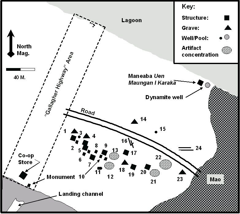
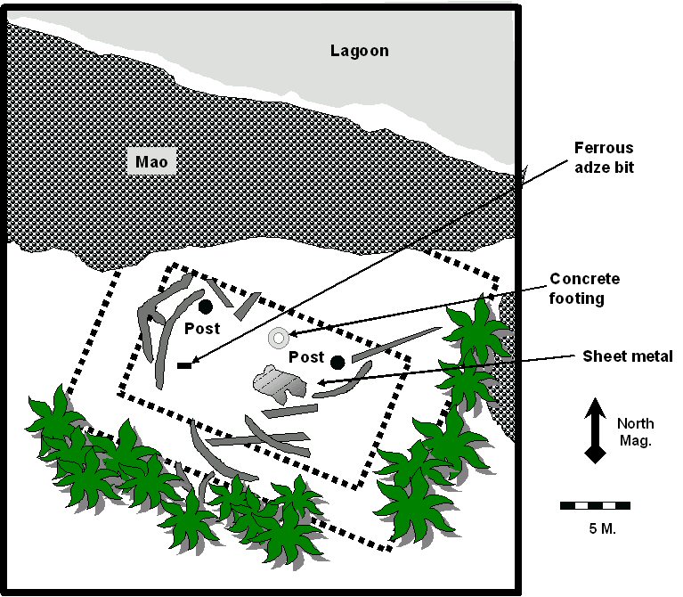
| 03:03, 1 January 2011 | Maneaba.jpg (file) |  |
158 KB | Tom King, Ph.D. Sketch-plan of putative maneaba site, based on 1989 field notes. | 1 |
| 01:56, 1 January 2011 | Lambrecht-combined.JPG (file) |  |
41 KB | Jose P. Isern Comas, 2010. | 1 |
| 01:45, 1 January 2011 | 1989-Survey.jpg (file) |  |
125 KB | Drawn Tom King, PhD. | 1 |
| 01:41, 1 January 2011 | Niku-VI-team.png (file) |  |
526 KB | Niku VI | 1 |
| 18:08, 27 December 2010 | Niku2.JPG (file) |  |
54 KB | Mark Petersen https://tighar.org/smf/index.php/topic,253.msg1303.html#msg1303 | 1 |
| 18:07, 27 December 2010 | 4830267755 b91c54421a b.jpg (file) |  |
85 KB | Erik https://tighar.org/smf/index.php/topic,253.msg1294.html#msg1294 | 1 |
| 18:05, 27 December 2010 | 4826642975 e8c0ba78a6 b.jpg (file) |  |
42 KB | Erik https://tighar.org/smf/index.php/topic,253.msg1287.html#msg1287 | 1 |
| 18:04, 27 December 2010 | 4827243842 3db63eb5d2 b.jpg (file) |  |
125 KB | Erik https://tighar.org/smf/index.php/topic,253.msg1286.html#msg1286 | 1 |
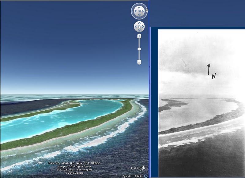
| 18:03, 27 December 2010 | Niku google earth.JPG (file) |  |
81 KB | Mark Peterson https://tighar.org/smf/index.php/topic,253.msg1275.html#msg1275 | 1 |
| 19:36, 23 December 2010 | Island.jpg (file) |  |
17 KB | 1 | |
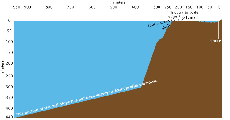
| 19:13, 23 December 2010 | Reefprofile.jpg (file) |  |
27 KB | 1 | |
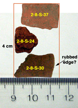
| 16:16, 18 December 2010 | 2-8-S-3-02.png (file) |  |
46 KB | 1 | |
| 16:16, 18 December 2010 | 2-8-S-3-01.png (file) |  |
79 KB | 1 | |
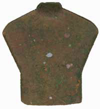
| 15:59, 18 December 2010 | Redstuff.jpg (file) |  |
25 KB | 1 | |
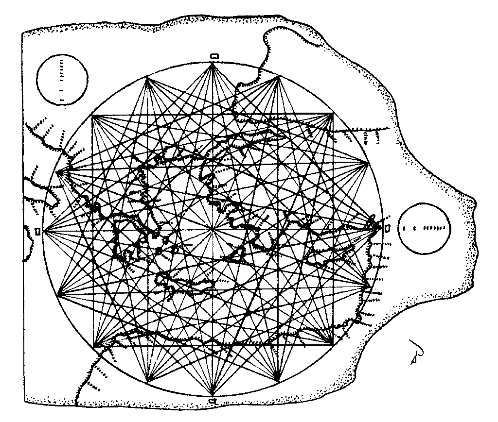
| 01:22, 11 October 2010 | Portolan Chart 1024.png (file) |  |
36 KB | Enhanced drawing of the Carta Pisana portolan navigational chart showing the method of portraying magnetic compass courses to the principal central and eastern Mediterranean ports. The mileage scale is depicted in the circles. Pilots did not reference lat | 1 |
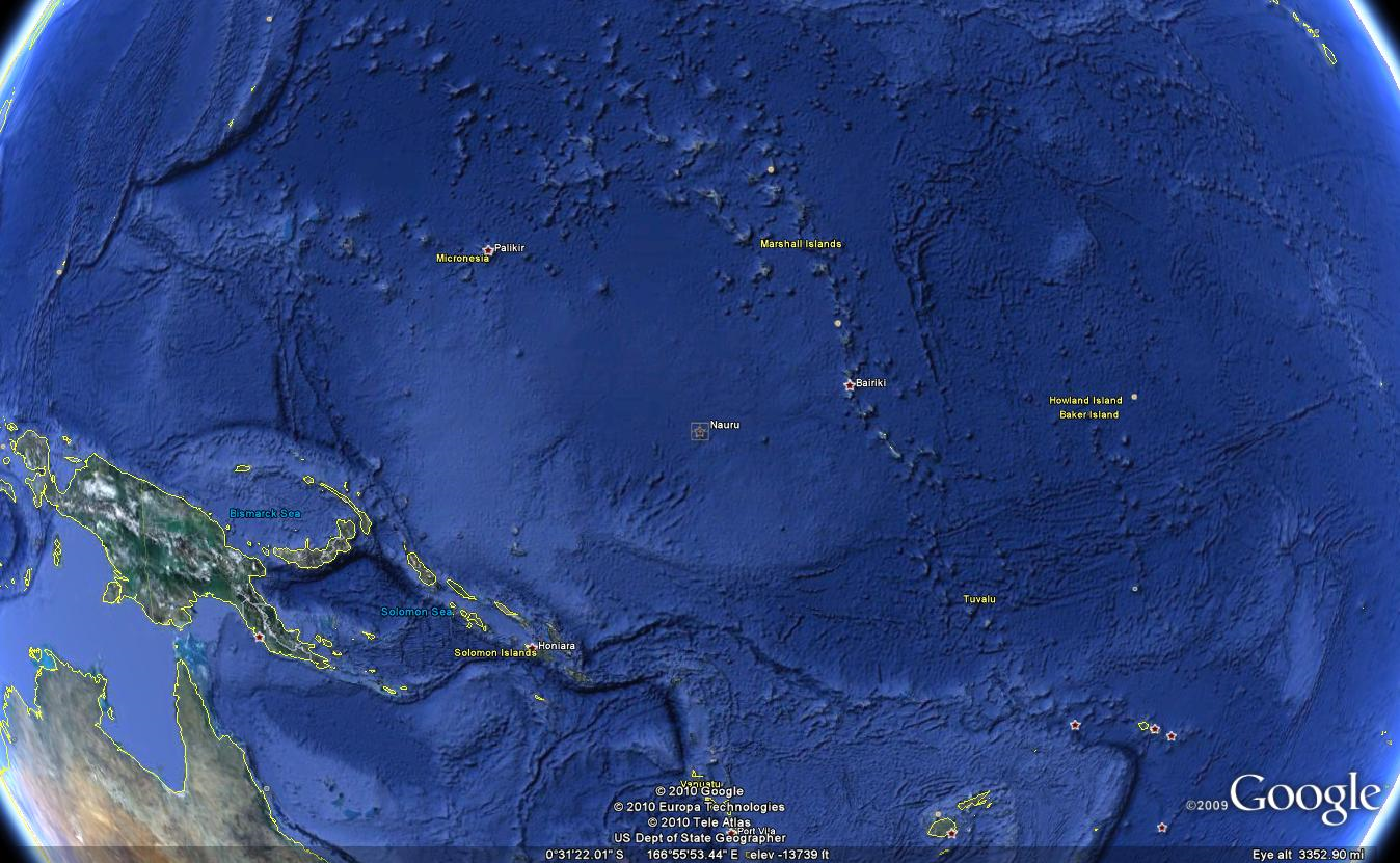
| 23:56, 1 August 2010 | Nauru.png (file) |  |
1.66 MB | Google Earth image capture 2010-08-01. | 1 |
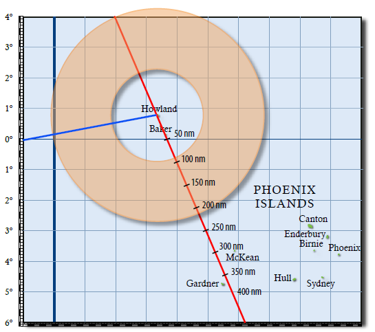
| 23:39, 3 July 2010 | 3105 donut.png (file) |  |
60 KB | TIGHAR Tracks 24 (2008) p. 3. | 1 |
| 04:26, 2 July 2010 | 55-foot line.png (file) |  |
1.33 MB | Google Earth image: -4.6611139,-174.53661 | 1 |
| 00:45, 2 July 2010 | 7 Site overlay and marker.png (file) |  |
1.06 MB | Google Earth image with Jim Thompson's .kmz KAP overlay of Niku V activity. | 1 |
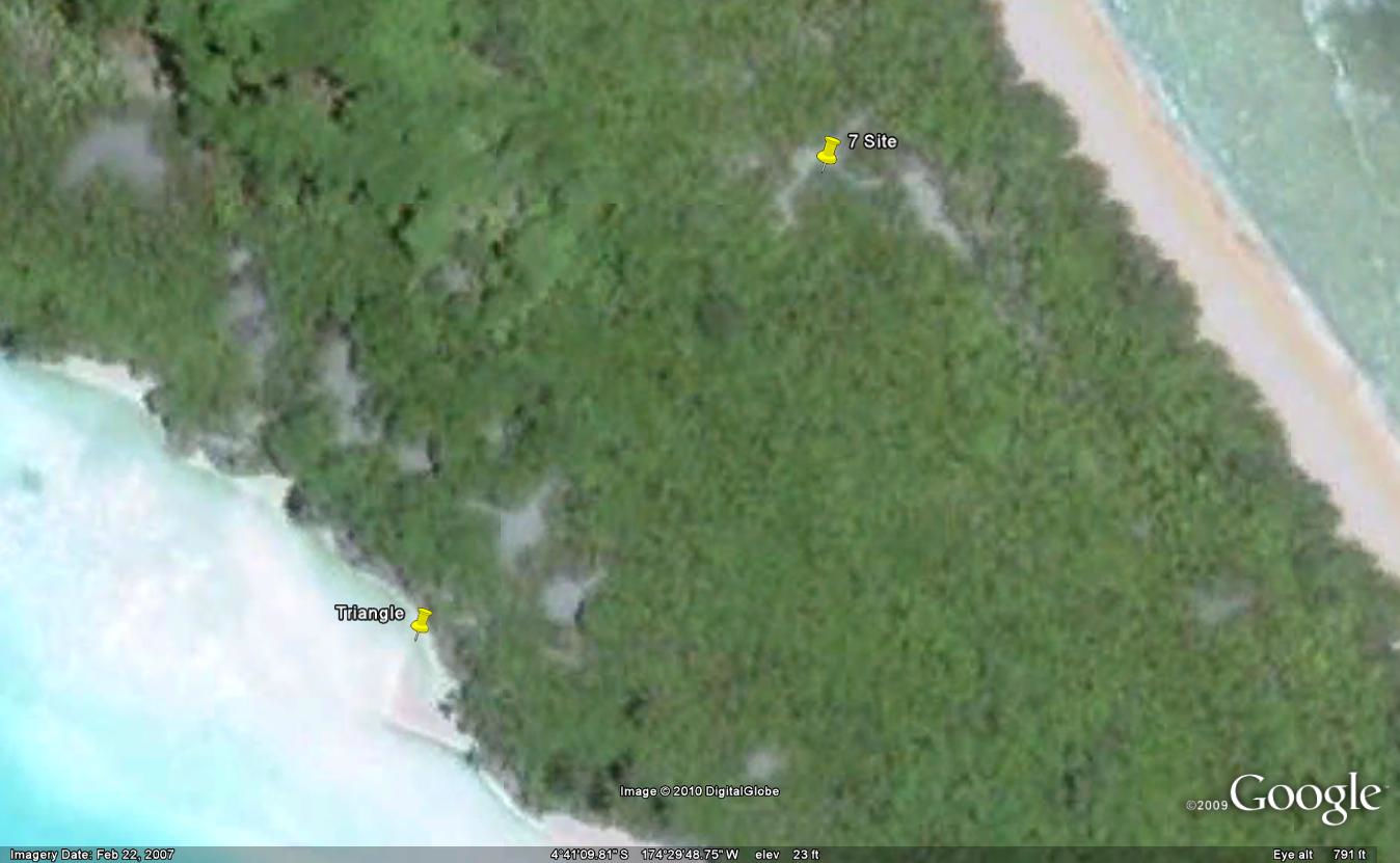
| 00:43, 2 July 2010 | Triangle.png (file) |  |
1.04 MB | Google Earth image: -4.6860622,-174.4966. More accurate location for 7 site. | 2 |
| 23:46, 1 July 2010 | Electra-on-land.png (file) |  |
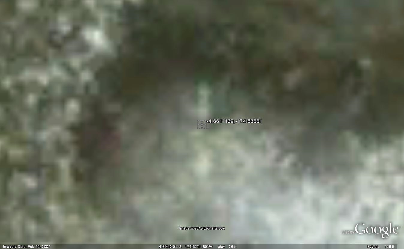
451 KB | Google Earth image: -4.6611139,-174.53661 | 1 |
| 23:08, 1 July 2010 | ELP.png (file) |  |
1,005 KB | Google Earth image: -4.6937396,-174.49409 | 1 |
| 23:02, 1 July 2010 | Atlantis.png (file) |  |
1.31 MB | Google Earth image. | 1 |
| 20:07, 30 June 2010 | 2-3-S-5.png (file) |  |
86 KB | Button found during Niku IIIP (1996). | 1 |
| 22:52, 10 June 2010 | Norwich-city.png (file) |  |
3.35 MB | Niku V (2007) KAP image of the Norwich City. | 1 |
| 22:45, 9 June 2010 | Niku Household Arch prospectus.pdf (file) | 1.64 MB | "Household Archaeology on Nikumaroro Island, Republic of Kiribati: A Prospectus." Tom King, April, 2003. | 1 | |
| 22:39, 9 June 2010 | Karaka village map.png (file) |  |
106 KB | Karaka Village map drawn by Tom King, 2003. | 1 |
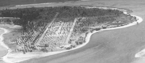
| 22:38, 9 June 2010 | Karaka village 1942.png (file) |  |
82 KB | Karaka Village, 1942; U.S. Navy. | 1 |
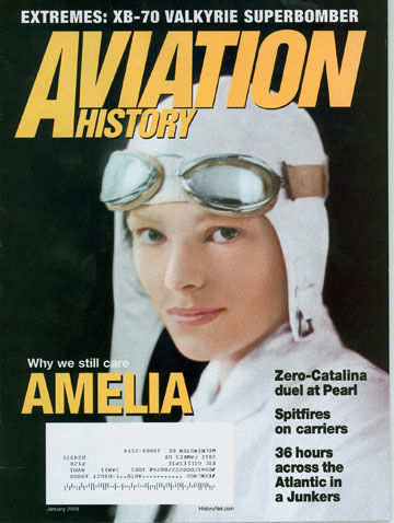
| 16:45, 8 June 2010 | AvHistAE.jpg (file) |  |
46 KB | January, 2010, cover of Aviation History. | 1 |