File list
Jump to navigation
Jump to search
This special page shows all uploaded files.
| Date | Name | Thumbnail | Size | User | Description | Versions |
|---|---|---|---|---|---|---|
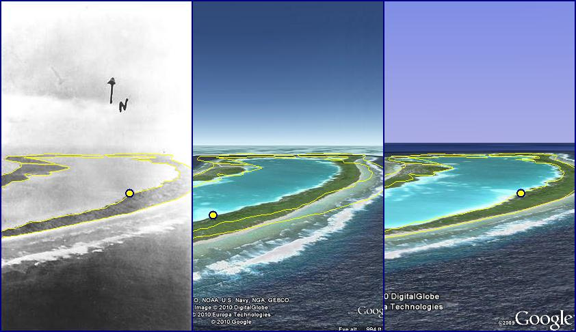
| 18:07, 27 December 2010 | 4830267755 b91c54421a b.jpg (file) |  |
85 KB | Moleski | Erik https://tighar.org/smf/index.php/topic,253.msg1294.html#msg1294 | 1 |
| 18:05, 27 December 2010 | 4826642975 e8c0ba78a6 b.jpg (file) |  |
42 KB | Moleski | Erik https://tighar.org/smf/index.php/topic,253.msg1287.html#msg1287 | 1 |
| 18:04, 27 December 2010 | 4827243842 3db63eb5d2 b.jpg (file) |  |
125 KB | Moleski | Erik https://tighar.org/smf/index.php/topic,253.msg1286.html#msg1286 | 1 |
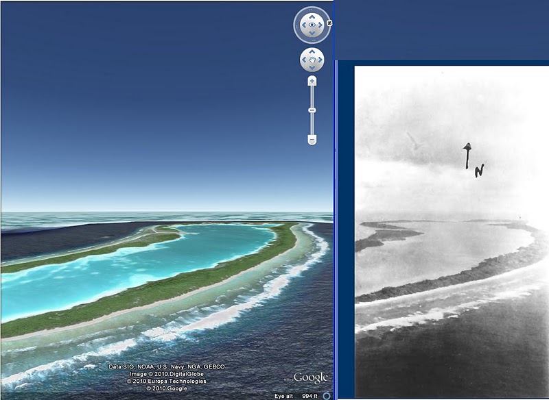
| 18:03, 27 December 2010 | Niku google earth.JPG (file) |  |
81 KB | Moleski | Mark Peterson https://tighar.org/smf/index.php/topic,253.msg1275.html#msg1275 | 1 |
| 19:36, 23 December 2010 | Island.jpg (file) |  |
17 KB | Moleski | 1 | |
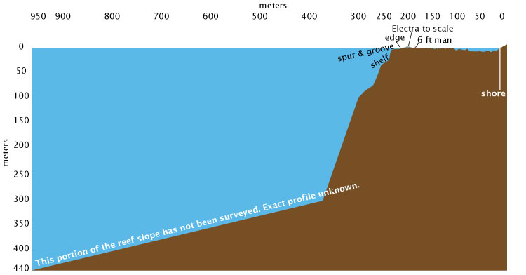
| 19:13, 23 December 2010 | Reefprofile.jpg (file) |  |
27 KB | Moleski | 1 | |
| 16:16, 18 December 2010 | 2-8-S-3-02.png (file) |  |
46 KB | Moleski | 1 | |
| 16:16, 18 December 2010 | 2-8-S-3-01.png (file) |  |
79 KB | Moleski | 1 | |
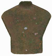
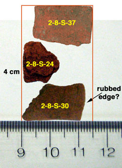
| 15:59, 18 December 2010 | Redstuff.jpg (file) |  |
25 KB | Moleski | 1 | |
| 04:36, 5 December 2010 | Sperry GyroPilot Automatic Pilot.jpg (file) |  |
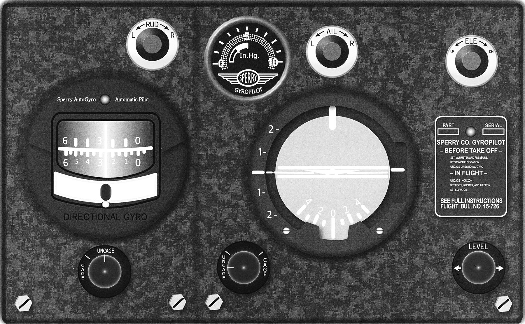
443 KB | Rickerjones | Sperry GyroPilot Automatic Pilot cockpit control unit. The gyroscopic stabilized autopilot improved the accuracy of sextant observations by reducing acceleration errors in the bubble chamber from aircraft axes movements. ((c)Tighar) | 1 |
| 00:07, 3 December 2010 | Dalton MK VII DR computer ca.jpg (file) |  |
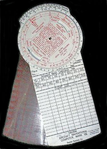
77 KB | Rickerjones | The Dalton Mk VII dead reckoning computer ca. 1935. Noonan's letter to P.V.H. Weems stated he used this model while flying the Pacific survey flights. (Used by permission.) | 1 |
| 23:53, 1 December 2010 | Potting Sheet Example.bmp (file) |  |
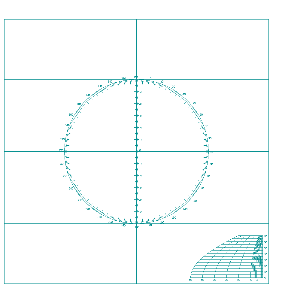
900 KB | Rickerjones | An example of a plotting sheet devoid of geographic features. Used off-shore, the navigator must assign the longitude (and in this example the latitude also) for the area he is traversing. The VP-3 and VP-4 used by Noonan while with Pan Am were similar. ( | 1 |
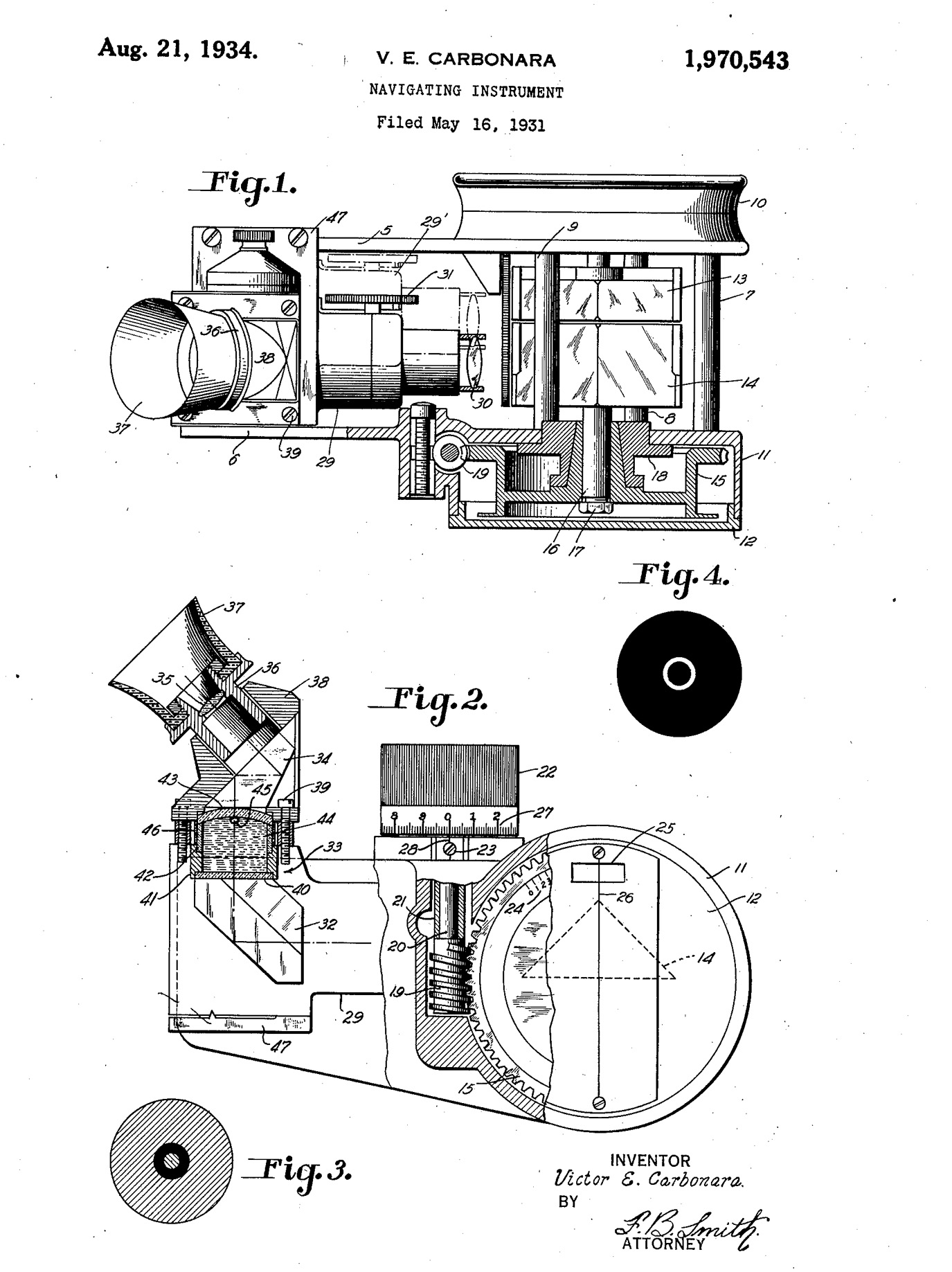
| 22:02, 30 November 2010 | Pioneer Mark III Octant Patent.jpg (file) |  |
454 KB | Rickerjones | Carbonara's 1934 patent of the Pioneer Mk III octant similar to the one used on the first attempt of the World Flight. The bubble chamber of this octant was difficult to adjust and the averager,which provided a mean of several observations over a few min | 1 |
| 21:24, 30 November 2010 | Nautical Almanac 2 Jul 37.jpg (file) |  |
362 KB | Rickerjones | This page of the 1937 American Nautical Almanac includes data for 2 July 1937. The Luke Field inventory listed two copies of this edition of the Nautical Almanac carried on board during the first attempt of the World Flight. (TIGHAR photo) | 1 |
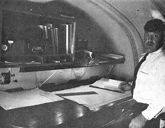
| 21:10, 30 November 2010 | M-130 Clipper Nav Station.jpg (file) |  |
98 KB | Rickerjones | The navigator's station on the M-130 Pan Am Clipper is shown with Flight Engineer Vic Wright. What may be Noonan's "preventer" in a Brandis sextant box is on the shelf above the chart table. (Used by permission) | 1 |
| 21:01, 30 November 2010 | Gatty-Weems Speed & Drift Indicator Patent.jpg (file) |  |
260 KB | Rickerjones | Harold Gatty and P.V.H. Weems collaborated on the "Speed and Drift Indicator" patented in 1934. Both men had numerous inventions relating to air navigation. | 1 |
| 20:43, 30 November 2010 | Electra Navigator's Station.jpg (file) |  |
1.46 MB | Rickerjones | The Electra's navigator's station was in the aft cabin behind the fuel tanks. Communication with the pilot was by written notes passed with a bamboo stick. ((c)William F. Harney,2006,(c)TIGHAR,2009) | 1 |
| 20:31, 30 November 2010 | Dreisonstok Reduction Tables & Nautical Almanac.jpg (file) |  |
1.29 MB | Rickerjones | Dreisonstok's sight reduction tables and the 1937 Nautical Almanac like those used by Noonan on the second attempt of the World Flight. The Dreisonstok tables were very compact, but required more arithmetical operations than some other available methods. | 1 |
| 20:20, 30 November 2010 | Ceramic Drift Bomb.jpg (file) |  |
33 KB | Rickerjones | Ceramic or glass drift bombs were filled with aluminum or bronze flakes and dropped over water during daylight, breaking on impact. The metal particles would spread to form a bright reflection which the navigator could follow with the drift sight. (Used b | 1 |
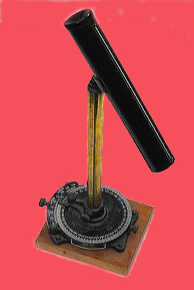
| 22:00, 29 November 2010 | MK IIB Pelorus Drift Sight.jpg (file) |  |
34 KB | Rickerjones | A Mark IIB pelorus drift sight like that installed on the Earhart Lockheed Electra 10E for the World Flight. A U.S. Army inventory made following the Luke Field accident included this type drift sight and an extra base, plausibly for mounting the drift si | 1 |
| 21:56, 29 November 2010 | MK II B Pelorus Drift Sight.jpg (file) |  |
34 KB | Rickerjones | enhanced and background change | 2 |
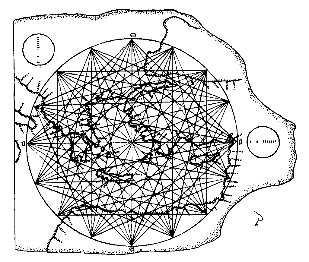
| 01:22, 11 October 2010 | Portolan Chart 1024.png (file) |  |
36 KB | Moleski | Enhanced drawing of the Carta Pisana portolan navigational chart showing the method of portraying magnetic compass courses to the principal central and eastern Mediterranean ports. The mileage scale is depicted in the circles. Pilots did not reference lat | 1 |
| 18:38, 2 October 2010 | Lifeboat diagram showing buoyancy tank location.jpg (file) |  |
230 KB | Rickerjones | The location of buoyancy tanks (air tanks) like those seen in the 1938 Norwich City shelter photo are shown in this lifeboat diagram. The tanks were shaped to fit the hull of the lifeboat. (Used by permission) | 1 |
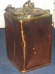
| 14:58, 2 October 2010 | Lifeboat ration tank (brass).jpg (file) | .jpg) |
34 KB | Rickerjones | Provision tanks like this watertight brass canister were carried aboard lifeboats. One of the tanks pictured near the center of the 1938 shelter photo may have been such a provision tank. (Used with permission) | 1 |
| 12:58, 2 October 2010 | Lifeboat Compass (Courtesy nauticalartifacts.com ).jpg (file) | .jpg) |
11 KB | Rickerjones | This lifeboat compass may be similar to what we see in the 1938 photo of the survivors' shelter. (Courtesy, nauticalartifacts.com) | 1 |
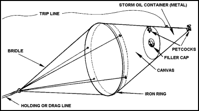
| 18:32, 30 September 2010 | Sea anchor with iron ring.bmp (file) |  |
92 KB | Rickerjones | Conical sea anchor similar to one in the 1938 NZ Pacific Aviation Survey photo which had deteriorated. Note the iron ring at the large end which is also still visible in the photo. (Courtesy of www.globalsecurity.org) | 1 |
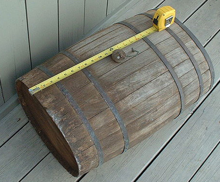
| 14:45, 30 September 2010 | Wooden Cask (TIGHAR photo by Andrew McKenna).jpg (file) | .jpg) |
119 KB | Rickerjones | Small wooden cask with a stopper on a chain similar to the water "breaker" pictured in the Norwich City's survivors' shelter. (TIGHAR photo by Andrew McKenna) | 1 |
| 21:33, 26 September 2010 | Wind diagram on NZ Survey countour map with North orientation.jpg (file) |  |
163 KB | Rickerjones | New Zealand Pacific Aviation Survey contour map of Gardner Island with a wind diagram of Dec 1938-Jan 1939 data. Winds depicted are 1-16 mph and 17-32 mph. Calm:Nil Rain: Nil The map has been rotated so that North is at the top.(Courtesy , Wigram Air Forc | 1 |
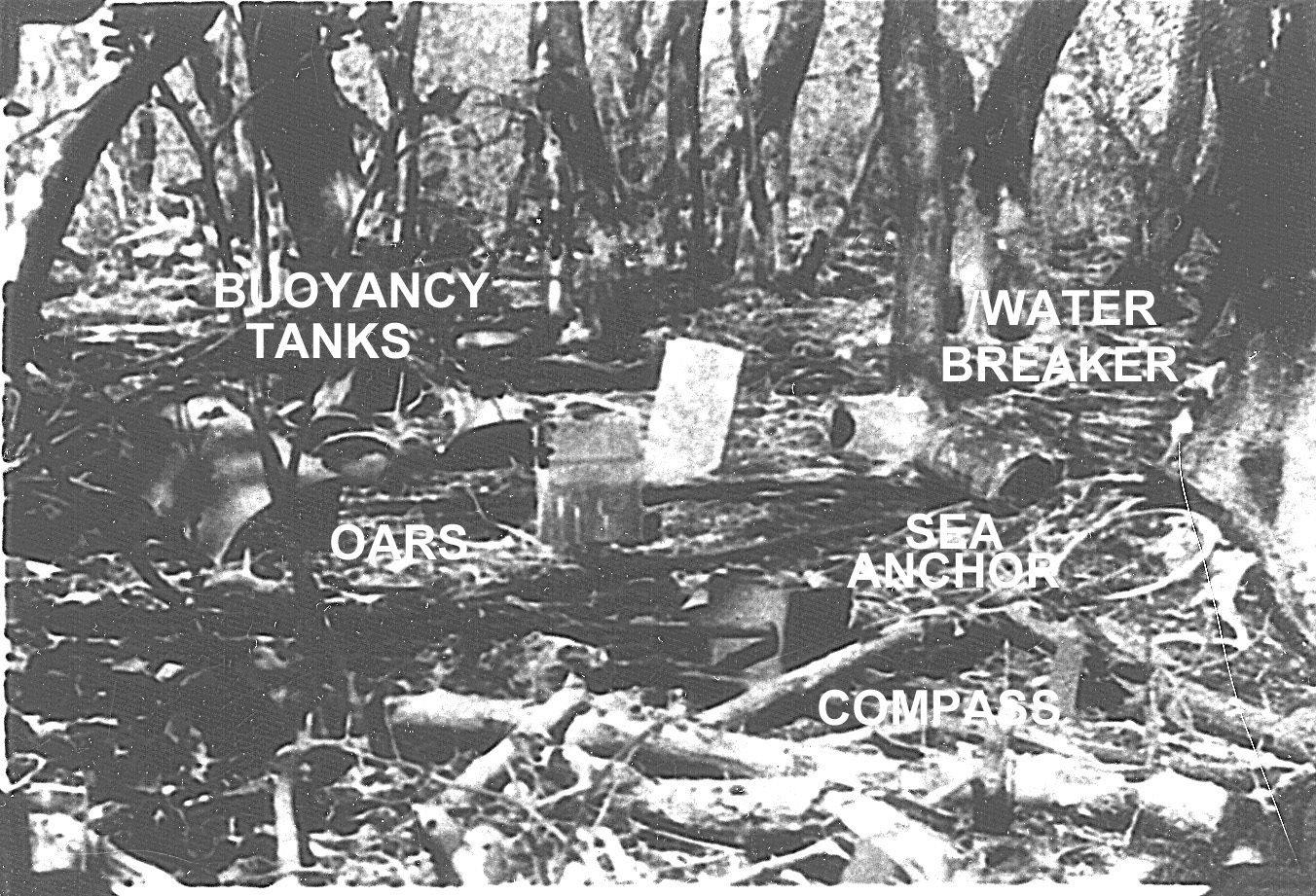
| 20:54, 26 September 2010 | Norwich City survivor's camp in 1938.jpg (file) |  |
566 KB | Rickerjones | Norwich City survivors' camp photographed by the New Zealand Pacific Aviation Survey Expedition still showing identifiable equipment. (Courtesy, Wigram Air Force Base Archives, RNZAF) | 1 |
| 18:06, 10 August 2010 | Putnam to Miller re Pan Am Nav.pdf (file) | 3.69 MB | Rickerjones | This letter from George P. Putnam to William T. Miller hints that the Putnams were uneasy with the aeronautical navigational experience level of Capt. Harry Manning, and were exploring alternatives. (courtesy of the John W. Davidson, Jr. family) | 1 | |
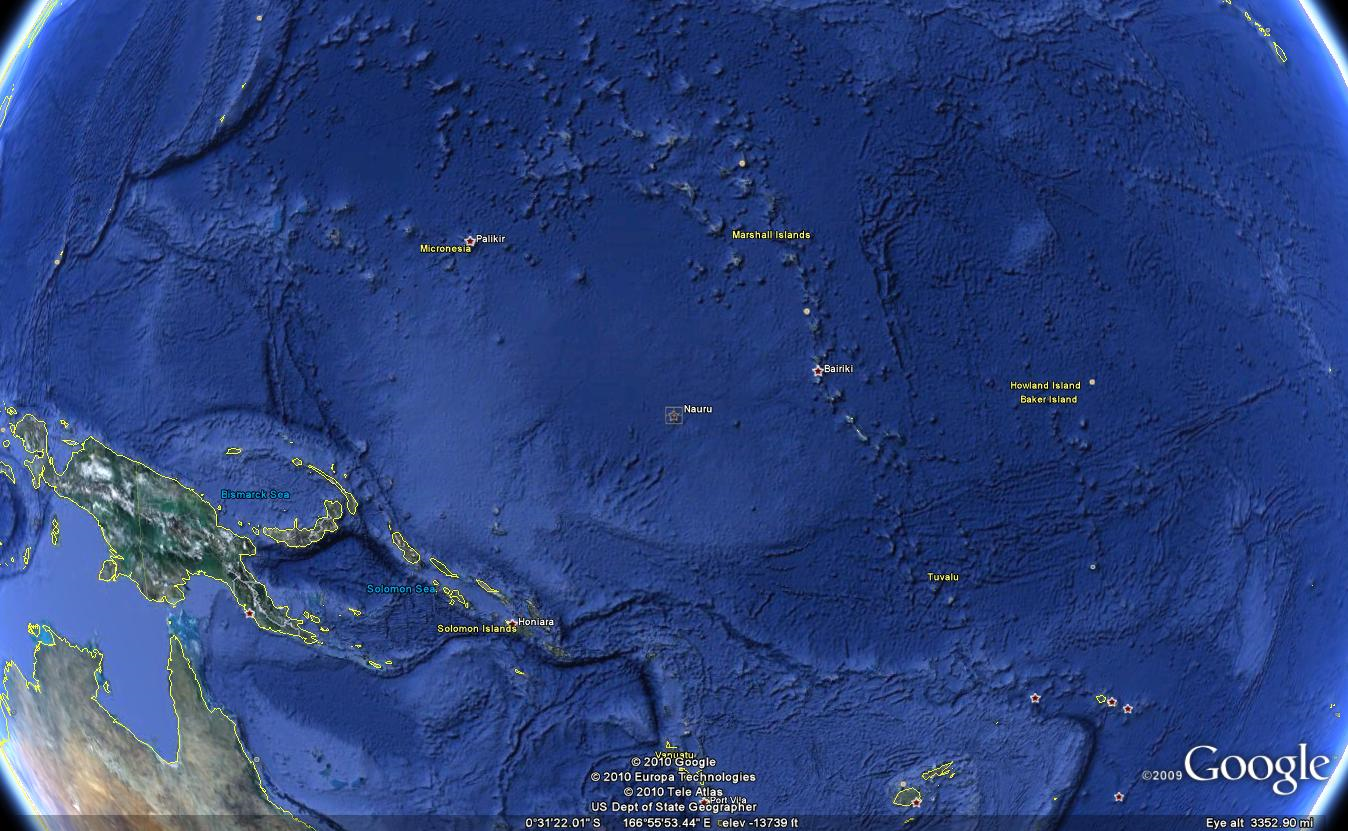
| 23:56, 1 August 2010 | Nauru.png (file) |  |
1.66 MB | Moleski | Google Earth image capture 2010-08-01. | 1 |
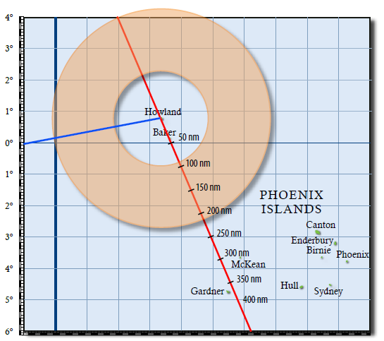
| 23:39, 3 July 2010 | 3105 donut.png (file) |  |
60 KB | Moleski | TIGHAR Tracks 24 (2008) p. 3. | 1 |
| 04:26, 2 July 2010 | 55-foot line.png (file) |  |
1.33 MB | Moleski | Google Earth image: -4.6611139,-174.53661 | 1 |
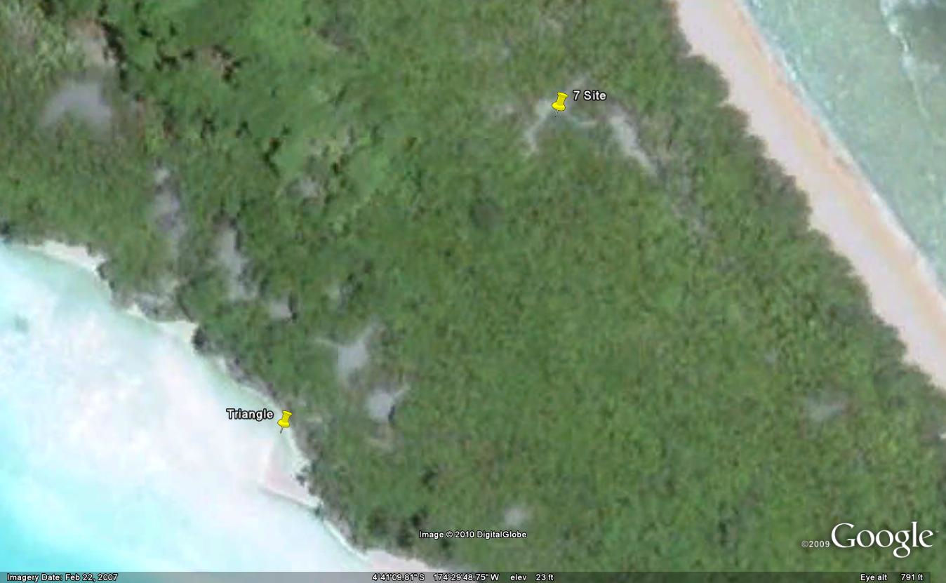
| 00:45, 2 July 2010 | 7 Site overlay and marker.png (file) |  |
1.06 MB | Moleski | Google Earth image with Jim Thompson's .kmz KAP overlay of Niku V activity. | 1 |
| 00:43, 2 July 2010 | Triangle.png (file) |  |
1.04 MB | Moleski | Google Earth image: -4.6860622,-174.4966. More accurate location for 7 site. | 2 |
| 23:46, 1 July 2010 | Electra-on-land.png (file) |  |
451 KB | Moleski | Google Earth image: -4.6611139,-174.53661 | 1 |
| 23:08, 1 July 2010 | ELP.png (file) |  |
1,005 KB | Moleski | Google Earth image: -4.6937396,-174.49409 | 1 |
| 23:02, 1 July 2010 | Atlantis.png (file) |  |
1.31 MB | Moleski | Google Earth image. | 1 |
| 20:07, 30 June 2010 | 2-3-S-5.png (file) |  |
86 KB | Moleski | Button found during Niku IIIP (1996). | 1 |
| 22:52, 10 June 2010 | Norwich-city.png (file) |  |
3.35 MB | Moleski | Niku V (2007) KAP image of the Norwich City. | 1 |
| 22:45, 9 June 2010 | Niku Household Arch prospectus.pdf (file) | 1.64 MB | Moleski | "Household Archaeology on Nikumaroro Island, Republic of Kiribati: A Prospectus." Tom King, April, 2003. | 1 | |
| 22:39, 9 June 2010 | Karaka village map.png (file) |  |
106 KB | Moleski | Karaka Village map drawn by Tom King, 2003. | 1 |
| 22:38, 9 June 2010 | Karaka village 1942.png (file) |  |
82 KB | Moleski | Karaka Village, 1942; U.S. Navy. | 1 |
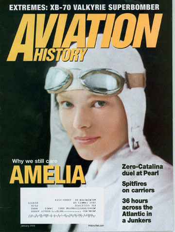
| 16:45, 8 June 2010 | AvHistAE.jpg (file) |  |
46 KB | Moleski | January, 2010, cover of Aviation History. | 1 |
| 01:11, 8 June 2010 | Bushnell image.jpg (file) |  |
25 KB | Moleski | 1 | |
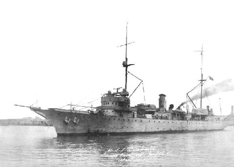
| 01:09, 8 June 2010 | Usssumner-ags5.jpg (file) |  |
50 KB | Moleski | USS Bushnell, renamed the USS Sumner. [http://upload.wikimedia.org/wikipedia/en/2/2c/Usssumner-ags5.jpg Wikimedia Commons] | 1 |
| 00:34, 8 June 2010 | Village kmz.png (file) |  |
1.36 MB | Moleski | Derived from KMZ drawn by James Thompson, Select GIS Services, 2009. | 1 |
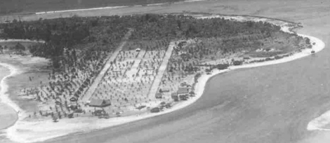
| 19:33, 7 June 2010 | 01sevensite.jpg (file) |  |
33 KB | Moleski | This was the Seven Site on Day 8 (September 5, 2001) of the Niku IIII expedition. | 1 |
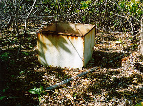
| 19:08, 7 June 2010 | Watertank.jpg (file) |  |
59 KB | Moleski | From "Gallagher's Clues." Niku IIIP (1996). | 1 |
| 18:44, 30 May 2010 | Floyd Kilts.jpg (file) |  |
160 KB | Rickerjones | Floyd Kilts | 1 |