Maps of Nikumaroro: Difference between revisions
Jump to navigation
Jump to search
No edit summary |
No edit summary |
||
| Line 33: | Line 33: | ||
''Bathymetric 3-D viewing is available with Google Earth 5.0. Select "View" and check "Water Surface". In the "Layers" panel, turn on "Terrain". For underwater features and content related to oceans, select "Ocean" in the "Layers" panel.'' | ''Bathymetric 3-D viewing is available with Google Earth 5.0. Select "View" and check "Water Surface". In the "Layers" panel, turn on "Terrain". For underwater features and content related to oceans, select "Ocean" in the "Layers" panel.'' | ||
== Links == | |||
* [http://upload.wikimedia.org/wikipedia/en/2/25/Nikumaroro_drawing.jpg Drawing from satellite photo.] | |||
<!-- Please leave this Category tag at the bottom of this article. Thanks! MXM, SJ --> | <!-- Please leave this Category tag at the bottom of this article. Thanks! MXM, SJ --> | ||
[[Category:Nikumaroro|Maps]] | [[Category:Nikumaroro|Maps]] | ||
Revision as of 04:54, 19 February 2009
 |
| Credits and analysis. |
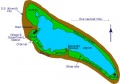
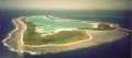
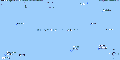
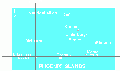
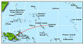
Map / Photo Gallery
-
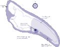
nikumap.jpg
-
nikumapanno.jpg
-
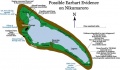
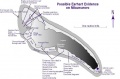
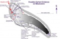
nikumapevidence.jpg
-
Nikumap15.gif
-

nikumapfred.jpg
-

nikumapplain.jpg
-
Nikumaroro.jpg
-
nikupic.jpg
-
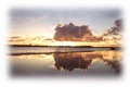
Nikusunrise.jpg
-
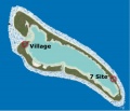
nikuVsitemap.jpg
-
phoenixgroup.gif
-
phoenixmap.gif
-

siteloc.jpg
-
Oceania.jpg
-
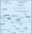
Kiribati_map.gif


| All drawings, images, and photographs ©TIGHAR 1985-2024. Not to be used, distributed, copied, bought, sold, or otherwise poached. For permission to use images, please email TIGHAR. |
Google Earth .kmz files
 Nikumaroro Seamount
To use .kmz files you must have Google Earth installed on your computer. Save the .kmz file on your computer where you can find it. Start Google Earth, select File / Open and then browse to the saved .kmz file. Nikumaroro will come into view. Bathymetric 3-D viewing is available with Google Earth 5.0. Select "View" and check "Water Surface". In the "Layers" panel, turn on "Terrain". For underwater features and content related to oceans, select "Ocean" in the "Layers" panel.