File:Niku GPS Mstr2.png: Difference between revisions
Jump to navigation
Jump to search
(Waypoints overlaid on outline of Niku Sat photo) |
No edit summary |
||
| Line 1: | Line 1: | ||
{{tcbug}} | |||
Waypoints overlaid on outline of Niku Sat photo | Waypoints overlaid on outline of Niku Sat photo | ||
Latest revision as of 17:22, 9 February 2009
| All drawings, images, and photographs ©TIGHAR 1985-2024. Not to be used, distributed, copied, bought, sold, or otherwise poached. For permission to use images, please email TIGHAR. |
Waypoints overlaid on outline of Niku Sat photo
File history
Click on a date/time to view the file as it appeared at that time.
| Date/Time | Thumbnail | Dimensions | User | Comment | |
|---|---|---|---|---|---|
| current | 16:01, 9 February 2009 | 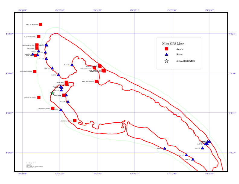 | 792 × 612 (78 KB) | McKenna (talk | contribs) | Waypoints overlaid on outline of Niku Sat photo |
You cannot overwrite this file.
File usage
The following page uses this file: