Earhart Logo

Niku VI header

PIPAhead

Niku VI logo
The Phoenix Islands Protected Area (PIPA) is the largest marine protected area in the Pacific Ocean. As part of the permitting process which enables us to work on Nikumaroro, we are required to submit a report to PIPA at the end of each expedition, describing what we did, what we saw, and including video and still images of the island and its environment. The report was delivered in person by Ric Gillespie on June 23, 2011, in Tarawa, and is published below. There are also numerous appendices which are published in the Analysis section.

EXPEDITION REPORT
to the
Phoenix Islands Protected Area Management Committee

Page 3.
AREAS COVERED, cont.

The next object described in the application was

b. To carry out focused research in the old colonial village at Ritiati in the north-central part of the island. Specifically, we want to excavate one or more cooking sites in the village to confirm that the cooking sites identified at the Seven Site are unlike those used by the colonists and are more consistent with a European castaway.

This objective was not achieved. Despite several attempts, a discreet cooking site could not be found in the abandoned village.


c.    To conduct an underwater Remote Operated Vehicle (ROV) search of the reef slope along the island’s western shoreline to test the hypothesis that the area holds wreckage from the Earhart aircraft.

ROV
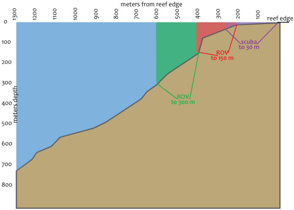
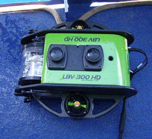
This objective was partially achieved. The underwater search component of the expedition was contracted to Seabotix, Inc., a manufacturer of small Remote Operated Vehicles (ROVs) known as Little Benthic Vehicles (LBVs). Jesse Rodocker, Seabotix Director of Marketing, operated the LBV assisted by TIGHAR team members John Clauss and Walt Holm.

An area off the west end of the atoll roughly 1,400m long (north and south) and 300m wide (east and west) was searched to a depth of 150m. An area approximately 400m long (north and south) and 150m wide (east and west) was searched to a depth of 300m.

The underwater search was not as extensive as had been planned due to equipment and weather problems. Except for the expected wreckage from the SS Norwich City, very little man-made material was identified and none was immediately identifiable as airplane debris.

The reef slope was found to be steeper than anticipated. Any aircraft debris is likely to be deeper than this expedition was equipped to search.

Depths searched Reef profile

Approximately 80% of the lagoon was surveyed using side-scan sonar. Several anomalies were found but could not be identified by divers due to low visibility.

d.    Make observations to assist in measuring the extent to which rising sea levels are eroding the island shoreline, particularly along the Ritiati shore where we have observed steadily increasing damage over the last fifteen years or so.

This objective was achieved. No significant erosion of the island shoreline was observed since our last visit in 2007 but there was clear evidence along the atoll’s west shoreline of continued seawater incursions inland during storms.


About TIGHAR Join TIGHAR TIGHAR Projects TIGHAR Publications Contract Services
The TIGHAR Store TIGHAR Forum Contact TIGHAR TIGHAR Home

TIGHAR logo

Copyright 2021 by TIGHAR, a non-profit foundation. No portion of the TIGHAR Website may be reproduced by xerographic, photographic, digital or any other means for any purpose. No portion of the TIGHAR Website may be stored in a retrieval system, copied, transmitted or transferred in any form or by any means, whether electronic, mechanical, digital, photographic, magnetic or otherwise, for any purpose without the express, written permission of TIGHAR. All rights reserved.

Contact us at: info@tighar.org  •   Phone: 610.467.1937   •   JOIN NOW