For this kind of work there are two priorities – feet and water. If you don’t take care of your feet you’ll soon be hors de combat (out of action). If you don’t stay hydrated you’ll be in bigger trouble.
Footgear is highly individual. Wear shoes or boots you can hike in all day in rough terrain without getting blisters. I wear New Balance Dunham Cloud hiking boots. Whatever you choose it’s a good idea to bring two pair. Despite your best efforts, your boots could get wet and not dry overnight.
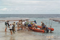
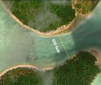
You’ll want something to wear in the skiff and for transiting to the shore at the landing channel – some kind of footgear that can get wet and provides protection for your feet on the coral. I use neoprene dive booties with a thick sole. I carry my hiking shoes and socks, and a towel, in a rubber “dry bag.” Once I’m ashore, I dry off my feet, change into my hiking boots, and leave the booties at the landing for the return trip. In this case, depending on how we set up the Tatiman Passage ferry, you might want to stay in the wet footgear until we get across the passage.
You’ll need to carry at least 2 liters of water on your person. How you do it is up to you. I prefer a CamelBak bladder. I’ll be wearing a 3 liter model. Some lucky devil will also get to carry a three and a half gallon jug of supplemental water on a pack frame.
You’ll also need to carry your lunch, whatever form that may take. The Nai’a galley will make you a sandwich and there will be an assortment of fruit and salty-crunchy stuff. You might want to bring along a supply of your favorite trail mix or power bars, etc.
Other incidentals: camera, sunblock, gloves, compass, small first aid kit.
 |
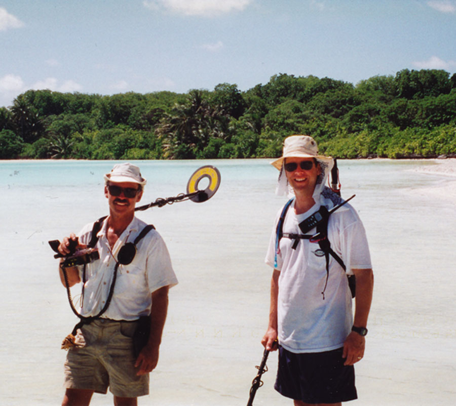
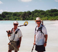
A couple of people will carry metal detectors. These will be Surfmaster PI Dual Field metal detectors provided to TIGHAR by White’s Electronics of Sweet Home, Oregon. White’s has been sponsoring TIGHAR’s work for over twenty years and many of our most significant discoveries have been made with White’s products. You’ll find them easy to use, rugged, reliable, and extremely sensitive. The new Surfmaster – waterproof down to 100 feet – will also be used by the Dive Team. So don’t worry if yours gets rained on. |
 |
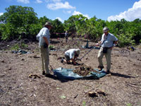
| Click on each photo to open a full-sized version in a new window. |
Gary and at least one other person will have a radio for communication with the ship.
Looking at the current satellite imagery I don’t think we’ll need to hack our way through any dense scaevola – for which we can be thankful – so carry a bush knife or machete only if you have a good one and know how to use it. Niku is a bad place to have an edged-weapon mishap. He who lives by the sword….
If all this is starting to remind you of a military patrol you get the idea. We’re putting boots on the ground with the ability to “shoot, move and communicate.” Our objective is to accomplish the mission – i.e. conduct a thorough, well-documented search – and bring everyone home in one piece. Nikumaroro is not a dangerous place if you respect it for what it is and come prepared to deal with the island on its own terms. We should have plenty of time to cover the area we want to examine so there’s no need to hurry or take chances if conditions are unfavorable. If we need to wait for the tidal flow to slacken before we cross the passage, we’ll wait. If you feel like you need to take a rest, let Gary know and take a rest. We’ve done ten expeditions to Nikumaroro without a serious injury because we’ve followed the principle that it’s not worth hurting live people to look for dead ones.
One last reminder: as the old saying goes, “No plan survives contact with the enemy.” We’ll need to stay flexible.

|