 |
Near Kellogg, Idaho
Field research was carried out on July 9–10, 2004. TIGHAR’s team was made up of seven members:
- Project Director: Walt Holm
- Logistics and Local Research: Bill Carter
- Researchers: John Clauss, Craig Fuller, Thomas King, Andrew McKenna, and Gary Quigg
We were accompanied and assisted on July 9 by Acting Forest Archeologist Mervin Floodman, and by Quanah Matheson and John Hartman of the Coeur d’Alene Tribe. Mr. Floodman participated on July 10 as well.
Having traveled by 4-wheel drive vehicle to within two miles of the drainage thought most likely to contain the wreck, the team back-packed in to the area, supported by Mr. Shane Sheppard of Coeur d’Alene with an all-terrain vehicle (ATV). Arriving at a pre-selected campsite on the ridge above the headwaters of the stream in which the wreck was thought most likely to lie, the team undertook an initial reconnaissance of the headwaters within about 1–200 meters (320–650′) of the ridge crest.
Team members, plus Messers Floodman, Matheson and Hartman formed a skirmish line approximately ten meters (35′) from one another along the south side of the bowl forming the stream headwaters, and walked north, inspecting the ground in all directions. Within about half an hour, as team members began to break out of heavy brush and lodgepole pine forest into the more lightly vegetated, rocky terrain bordering the stream, the first pieces of aircraft aluminum were found, and it was soon apparent that the streambed itself was choked with wreckage.
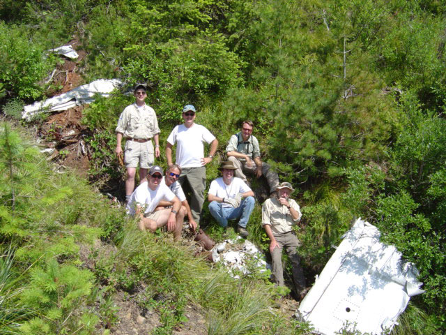
TIGHAR survey team on wreck site.
Having thus located the NC 14935 site, the team conducted an initial inspection, which indicated that the wreckage tailed off about 150 meters (500′) down the ravine.8 It was also apparent that the aircraft parts present were predominantly from the engines, landing gear, and wings; fuselage elements were notably absent. Two alternative reasons for the lack of fuselage parts were advanced: (1) that the fuselage had washed farther downstream, and (2) that it had been salvaged at some point in the past for aluminum scrap, souvenirs, or both.
On July 10th, a three-man team (John Clauss, Bill Carter, Andrew McKenna) worked their way downstream about 4/10 of a mile (650 meters) from the lower end of the wreckage site to the point where the stream debouches into a larger creek, inspecting both banks and the stream bed for wreckage. The remainder of the team, assisted by Mr. Floodman, prepared a measured sketch-map of the wreckage site (Figure One). Gary Quigg and Walt Holm scoured the ravine and its banks, marking wreckage with pin-flags, while Craig Fuller and Tom King followed, laying out a measured baseline, identifying and mapping wreckage clusters, taking reference photographs, and recording GPS coordinates and elevations.9 Work was completed by about 2 pm, whereupon the team packed all gear and retired from the site. No permanent markers were left on or around the site.
 |
Copyright 2021 by TIGHAR, a non-profit foundation. No portion of the TIGHAR Website may be reproduced by xerographic, photographic, digital or any other means for any purpose. No portion of the TIGHAR Website may be stored in a retrieval system, copied, transmitted or transferred in any form or by any means, whether electronic, mechanical, digital, photographic, magnetic or otherwise, for any purpose without the express, written permission of TIGHAR. All rights reserved. Contact us at: info@tighar.org • Phone: 610.467.1937 • JOIN NOW |