 |
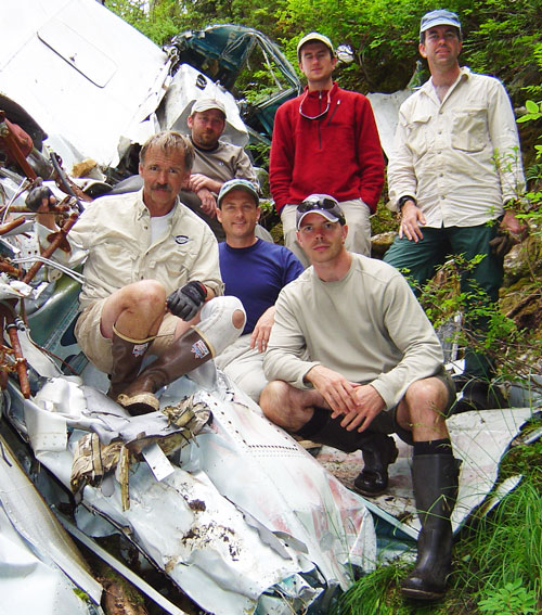 |
| TIGHAR/USFS survey team on wreck site. TIGHAR photo by Bill Carter. |
Field research on site at 49-KET-00910 was executed on August 3-4, 2004. TIGHAR’s team consisted of four members:
Project Director: Walt Holm Project Field Manager: Bill Carter Deputy Project Archaeologist: Gary Quigg Field Technician: John Clauss
(TIGHAR’s Project Archaeologist Thomas F. King, Ph.D., was unavailable to be on site.)
We were accompanied and assisted by the following personnel from the Ketchikan/Misty Fjords Ranger District, Tongass National Forest:
Archaeologist: Martin Stanford Forestry Technician: Chris Prew Wildlife Technician: Jeff Garnette
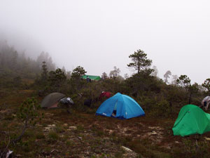
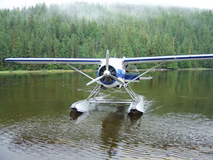 On August 2, two floatplanes from Taquan Air shuttled all personnel and gear
from Ketchikan to Badger Bay where the team began a backpacking trek to a
base campsite pre-selected by air reconnaissance. Reaching the base campsite
in the late morning of the second day, all personnel except Mr. Garnette
(who was suffering from a sprained back) proceeded to the wreck site after
pitching camp.
On August 2, two floatplanes from Taquan Air shuttled all personnel and gear
from Ketchikan to Badger Bay where the team began a backpacking trek to a
base campsite pre-selected by air reconnaissance. Reaching the base campsite
in the late morning of the second day, all personnel except Mr. Garnette
(who was suffering from a sprained back) proceeded to the wreck site after
pitching camp.
Following a heading toward the GPS coordinates established by a fly-over the previous week, the wreckage was located late in the afternoon of August 3. Due to the late hour of arrival at the crash site the team performed an initial inspection of the area, which revealed the wreckage remained tightly concentrated along a steep drainage. All major aircraft components appeared present except for the engines, propellers, control wheels and rudders. Site management duties for the following day were then discussed before the group hiked back to base camp for the evening.
 |
 |
Copyright 2021 by TIGHAR, a non-profit foundation. No portion of the TIGHAR Website may be reproduced by xerographic, photographic, digital or any other means for any purpose. No portion of the TIGHAR Website may be stored in a retrieval system, copied, transmitted or transferred in any form or by any means, whether electronic, mechanical, digital, photographic, magnetic or otherwise, for any purpose without the express, written permission of TIGHAR. All rights reserved. Contact us at: info@tighar.org • Phone: 610.467.1937 • JOIN NOW |